Introduction to Satellite Farming
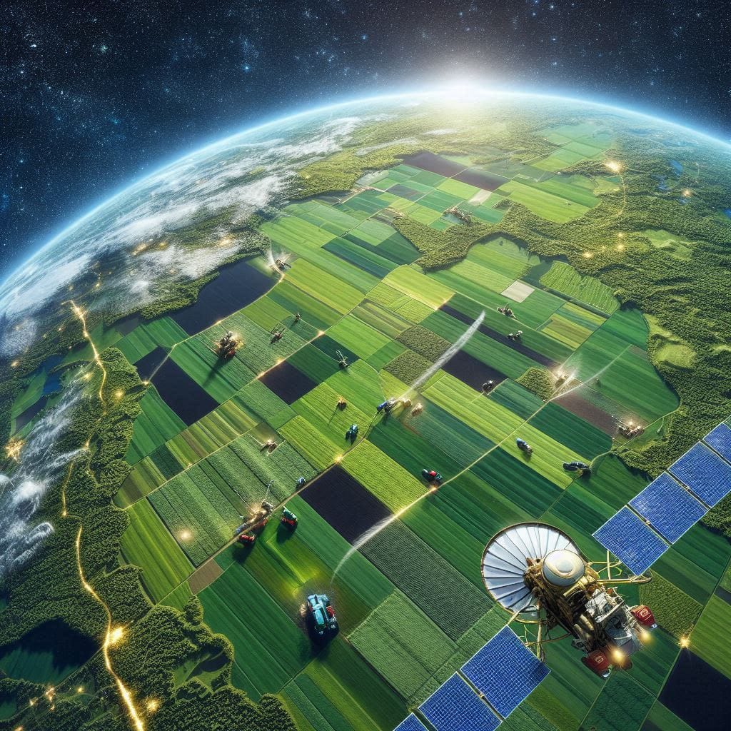
Satellite farming, a powerful technology in farming, is transforming agriculture through the innovative use of satellite technology. This method, also known as precision agriculture, uses satellite data to optimize crop yields, reduce waste, and conserve resources. By providing detailed insights into crop health, soil moisture, and field variability, satellite farming equips farmers with the data needed to make precise decisions that maximize productivity and minimize environmental impact.
This advancement in agricultural technology is more than just an innovation; it’s a necessary response to global challenges like food security, climate change, and sustainable land use. With a comprehensive view of vast agricultural landscapes, farmers can use satellite farming to understand and manage their resources better, creating a new wave of efficiency and sustainability in modern agriculture. As innovation in agriculture continues to grow, satellite farming represents a crucial component of the agricultural future, addressing the need for smarter, data-driven farming methods.

What is Satellite Farming?
What is satellite farming? At its core, Satellite-assisted farming, a component of satellite agriculture, utilizes data gathered from Earth-orbiting satellites to monitor and optimize agricultural activities. Through the use of farm satellites, farmers access crucial data on crop growth, soil health, moisture levels, and other environmental factors over extensive land areas. This process relies on remote sensing in agriculture—a technology that enables data collection from a distance, allowing analysis of conditions on the ground without requiring physical contact.
Satellite farming operates by capturing data from various sensors on satellites, which can detect information beyond human-visible light. This data includes multispectral and infrared images that reveal different aspects of plant and soil health. For example, healthy plants absorb and reflect light differently compared to stressed or diseased plants. By detecting these light patterns, Satellite-assisted farming systems can pinpoint areas in need of intervention.
The history of satellite agriculture dates back to the 1970s, when early Earth-observing satellites started capturing imagery for scientific and environmental monitoring. Although initial images were low-resolution and lacked detail, they laid the groundwork for today’s highly detailed, multispectral imaging capabilities, which allow for in-depth monitoring of crops and fields. Over the decades, advances in satellite technology have transformed the data from static snapshots into real-time, actionable insights, enabling farmers to respond promptly to changes in field conditions. As what is satellite farming evolved, it has become a cornerstone of precision agriculture, a farming approach that uses data to tailor crop management practices to specific conditions, maximizing both productivity and sustainability. This evolution from basic observation to data-driven precision demonstrates the significant impact that satellite technology has had on modern agriculture.
How Farm Satellites Work in Agriculture
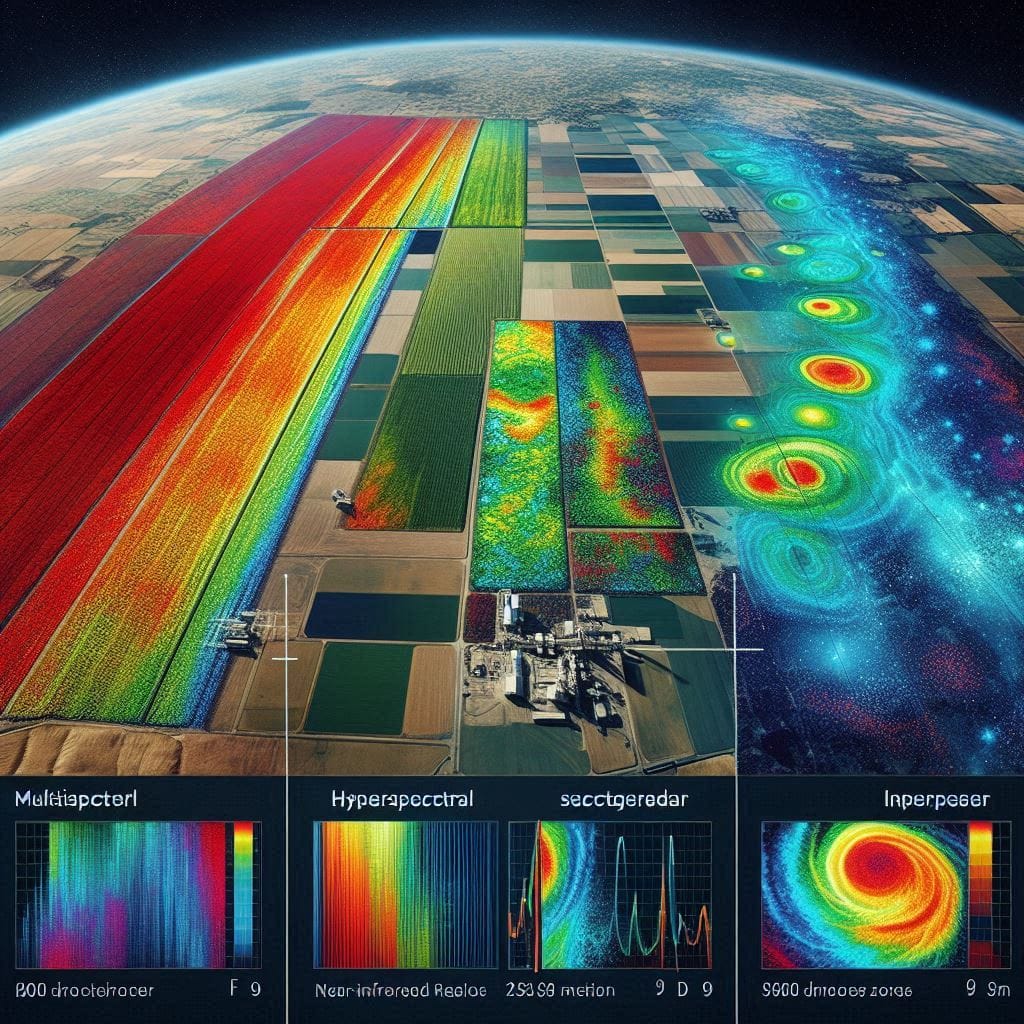
Farm satellites play a crucial role in satellite farming, utilizing different types of imagery to capture essential data on crop health, soil quality, and environmental conditions. Remote sensing technology is central to this process, using specialized satellite cameras that capture images across multiple spectra, including multispectral, hyperspectral, and infrared wavelengths. Each of these image types offers unique insights into field conditions, helping farmers make informed decisions.
- Multispectral Imaging: This type of imagery captures data in several specific wavelengths, such as red, green, blue, and near-infrared. Multispectral data is particularly useful in tracking vegetation health since healthy plants reflect near-infrared light differently than stressed plants. By analyzing these reflections, farmers can detect early signs of crop stress, allowing them to intervene before problems worsen. Multispectral imagery helps with identifying areas affected by nutrient deficiencies, pest invasions, or other issues, enabling precision agriculture at scale.
- Hyperspectral Imaging: Hyperspectral imaging takes multispectral imaging a step further by capturing hundreds of narrow wavelength bands. This provides highly detailed information on crop composition, making it possible to assess nutrient levels, water content, and even the biochemical makeup of plants. Hyperspectral data allows for extremely precise interventions, such as targeting specific nutrients for specific areas, improving crop health and yields.
- Infrared Imaging: Infrared imagery is valuable for monitoring soil moisture and temperature. Since infrared light interacts with moisture differently, infrared imaging can map soil moisture levels across a field. This allows farmers to optimize irrigation, applying water only where needed and reducing wastage. Infrared imaging also helps in identifying areas where soil is too dry or wet, which can inform adjustments in precision irrigation practices.

After collection, data from agricultural satellite monitoring is processed using algorithms and software that convert raw imagery into actionable insights. For example, multispectral data may be translated into vegetation indices, like the Normalized Difference Vegetation Index (NDVI), which provides a standardized way to gauge plant health. Similarly, infrared images can be analyzed to highlight moisture patterns across a farm. These insights allow farmers to conduct targeted interventions, conserving resources while boosting productivity. By supporting precise, data-driven approaches, farm satellites make satellite farming an eco-friendly, cost-effective approach that aligns with modern demands for sustainable agriculture.
Technologies Involved in Satellite Farming
The technology in farming that enables satellite technology in agriculture relies on a combination of Geographic Information Systems (GIS), Global Positioning Systems (GPS), and Artificial Intelligence (AI). Each of these technologies contributes uniquely to the precision and effectiveness of satellite farming.
- GIS in agriculture: GIS systems are essential for mapping and analyzing geographical data. In satellite technology in agriculture, GIS is used to overlay satellite images onto real-world coordinates, allowing farmers to visualize crop and soil conditions across specific areas. This spatial mapping helps in identifying variations within fields, leading to more precise and efficient resource allocation.
- GPS agriculture: GPS technology enables farmers to pinpoint locations within their fields, a key component in precision agriculture. With GPS, farmers can use the data from farm satellites to direct machinery, apply fertilizers and pesticides, and manage planting with extreme accuracy. GPS also facilitates georeferenced data collection, which, when combined with satellite imagery, allows farmers to optimize each part of their fields individually.

- Artificial Intelligence and Machine Learning: AI and machine learning are becoming integral to satellite farming. These technologies process vast amounts of satellite data, identifying patterns and predicting potential issues such as crop diseases or pest infestations. Predictive models powered by machine learning help farmers make proactive decisions, ultimately enhancing crop resilience and yield. Additionally, AI systems can automate the analysis of satellite data, delivering actionable insights that save time and reduce human error.
Together, these advanced technologies make satellite technology in agriculture a powerful tool for sustainable and profitable farming. As these tools continue to evolve, they promise to drive further innovation, ensuring that satellite farming remains a cornerstone of efficient and environmentally responsible agricultural practices.
Applications of Satellite Farming Across Agriculture Stages
Satellite agriculture has a multitude of applications, each addressing a critical stage in the farming lifecycle. From planting to harvesting, farm satellites enable a deeper understanding of field conditions, promoting precise, data-driven decisions:
- Crop Monitoring: Satellite imagery enables continuous crop health monitoring. By capturing multispectral and infrared data, satellite agriculture can detect signs of plant stress, such as nutrient deficiencies or pest infestations, before they become visible to the human eye. This early detection allows farmers to take timely actions that protect and improve crop health.
- Soil Management: Understanding soil quality is vital to productive farming, and satellite technology helps by mapping soil moisture, nutrient levels, and texture. This data aids in planning optimal planting patterns, selecting crop types suited to soil conditions, and adjusting inputs, ultimately leading to healthier crops.

- Precision Irrigation: Water scarcity is a significant global challenge. Through satellite agriculture and precision irrigation techniques, farmers can access real-time data on soil moisture levels across their fields. This information ensures water is only applied where needed, conserving resources and preventing over-irrigation, which can harm crop roots.
- Yield Prediction: Satellite data aids in forecasting crop yields with greater accuracy by analyzing factors like crop density, weather patterns, and growth rates. Yield prediction enables farmers to anticipate market demands, plan logistics, and make informed financial decisions.
By implementing satellite agriculture across all stages of farming, growers can maximize efficiency and sustainability, creating a stronger foundation for modern agriculture.
Benefits of Satellite Farming
Satellite farming benefits are reshaping how farmers approach resource management, productivity, and sustainability:
- Improved Accuracy and Precision: The data provided by Satellite-assisted farming enables farmers to make precise decisions at a micro-level, from field sectioning to specific crop treatments. This level of detail minimizes waste and ensures resources are used where they’re most needed.
- Resource Conservation: Through precision agriculture, farmers can better manage water, fertilizers, and pesticides. Satellite data helps identify areas needing more or less input, reducing overall usage and fostering sustainable farming practices.
- Cost-Effectiveness: Although the initial investment in satellite agriculture may be high, the resulting efficiency reduces operational costs over time. By preventing crop losses and optimizing resource use, farmers can achieve higher profitability.
- Global Food Security: With the world’s population on the rise, satellite farming benefits contribute to global food security by increasing crop yields without expanding farmland. The ability to produce more food on the same land area addresses hunger and the need for sustainable food sources.
These satellite farming benefits illustrate why this technology is invaluable for future resource management in agriculture and for ensuring sustainable growth across the globe.
Challenges in Satellite Farming
While satellite farming is transformative, it faces several challenges that hinder its widespread adoption:
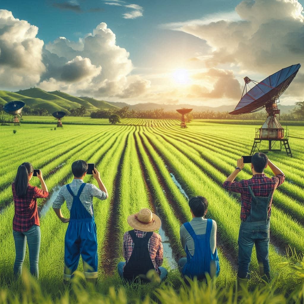
- Data Accessibility and Complexity: Accessing and interpreting satellite data is complex. Farmers need to understand and analyze various data points—such as crop health indices and soil moisture—requiring technical knowledge and sometimes additional training. Data accessibility in agriculture thus remains a significant barrier, especially for small-scale farmers.
- High Costs: Satellite farming costs can be prohibitive, as both satellite imagery and processing tools often involve substantial expenses. This cost barrier may exclude smaller farms or those in developing regions, where agricultural practices are typically less capital-intensive.
- Connectivity Issues: Connectivity in agriculture is another challenge, particularly in remote or rural areas with limited internet access. Without reliable connectivity, farmers may struggle to access real-time satellite data, undermining the responsiveness that makes satellite agriculture effective.
These challenges in satellite farming highlight the need for accessible, affordable technology solutions to ensure that more farmers can benefit from these innovations.
Future of Satellite Farming and Emerging Trends
The future of satellite farming is poised for rapid advancements, driven by emerging technologies and new trends in satellite agriculture:
- Low-Earth Orbit Satellites: With the launch of more low-Earth orbit (LEO) satellites, satellite data is becoming more accessible and affordable. LEO satellites offer high-resolution imagery and revisit times that allow farmers to monitor changes in near-real-time, enhancing the accuracy of agricultural data.
- Drone Integration: The combination of drone technology in farming with satellite data is a growing trend. While satellites provide a broad view, drones can capture finer details and verify satellite data at a close range, creating a comprehensive, multi-layered data system.
- AI and Machine Learning: The role of AI in agriculture continues to expand. AI algorithms analyze satellite data to predict weather patterns, crop diseases, and yield potential, allowing farmers to anticipate and mitigate risks effectively. As AI advances, it will enable satellite agriculture to be even more precise and responsive.
As these technologies evolve, the future of satellite farming holds promise for smarter, more efficient, and inclusive farming practices. This progress not only aids in addressing global agricultural challenges but also supports farmers worldwide in producing sustainable, high-quality crops.
Conclusion
In conclusion, satellite farming stands at the forefront of modern agricultural innovation, offering a transformative approach to farming by integrating data-driven insights and sustainable practices. Through advanced satellite technology, farmers can now access real-time information on soil moisture, nutrient levels, and crop health, enabling them to make more precise decisions on irrigation, fertilization, and pest management. This level of precision not only optimizes resource use—significantly reducing water, fertilizer, and pesticide waste—but also minimizes environmental impact by decreasing emissions and chemical runoff into ecosystems.
Additionally, satellite farming empowers farmers to monitor large areas of farmland remotely, detecting early signs of crop stress, disease, or nutrient deficiencies. This ability to anticipate and address issues before they escalate helps stabilize yields, reduces crop losses, and ultimately increases food security. As agricultural technology evolves, satellite farming is set to play an increasingly vital role in meeting the growing demand for food sustainably, addressing the challenges posed by climate change, and promoting a more resilient agricultural landscape.
Curious about more innovations in satellite farming technology? Explore how precision agriculture is changing the world of farming! Share your thoughts, or check out related articles to dive deeper into:
- The Role of Bioengineering in Modern Agriculture
- Vertical Farming 101
- Sustainable Green Technologies
- History of Agriculture
- Ocean Vertical Farming


